
Raon topographic map
Interactive map
Click on the map to display elevation.
About this map
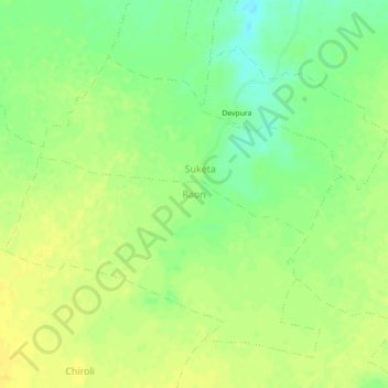
Name: Raon topographic map, elevation, terrain.
Location: Raon, Datia Tahsil, Datia District, Madhya Pradesh, Inde (25.74355 78.54452 25.78355 78.58452)
Average elevation: 195 m
Minimum elevation: 181 m
Maximum elevation: 203 m