
Namur Lake 174A topographic map
Interactive map
Click on the map to display elevation.
About this map
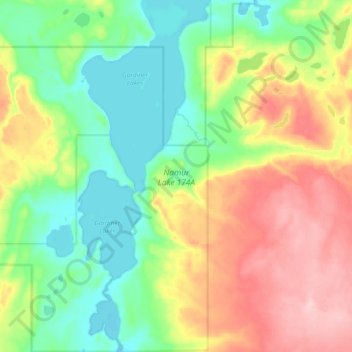
Name: Namur Lake 174A topographic map, elevation, terrain.
Location: Namur Lake 174A, Wood Buffalo, Alberta, Canada (57.45348 -112.67436 57.57100 -112.46811)
Average elevation: 732 m
Minimum elevation: 669 m
Maximum elevation: 831 m
Other topographic maps
Click on a map to view its topography, its elevation and its terrain.
Anzac
Canada > Alberta > Wood Buffalo
Anzac, Wood Buffalo, Alberta, T0P 1J0, Canada
Average elevation: 491 m
Fort Chipewyan
Canada > Alberta > Wood Buffalo > Fort Chipewyan
Fort Chipewyan, Wood Buffalo, Alberta, T0P 1B0, Canada
Average elevation: 217 m
Fort McMurray
Canada > Alberta > Wood Buffalo
Fort McMurray, Wood Buffalo, Alberta, Canada
Average elevation: 345 m