
Pownal topographic map
Interactive map
Click on the map to display elevation.
About this map
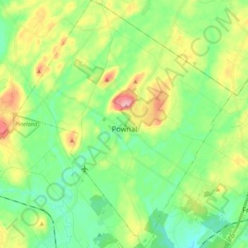
Name: Pownal topographic map, elevation, terrain.
Location: Pownal, Cumberland County, Maine, 04069, United States (43.84072 -70.24862 43.94794 -70.11852)
Average elevation: 54 m
Minimum elevation: 7 m
Maximum elevation: 145 m
Other topographic maps
Click on a map to view its topography, its elevation and its terrain.
Birch Island
United States > Maine > Cumberland County > Harpswell > Birch Island
Average elevation: 3 m