
Buckinghamshire topographic map
Interactive map
Click on the map to display elevation.
About this map
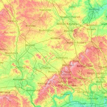
Name: Buckinghamshire topographic map, elevation, terrain.
Location: Buckinghamshire, Angleterre, Royaume-Uni (51.48547 -1.14070 52.19632 -0.47662)
Average elevation: 103 m
Minimum elevation: 13 m
Maximum elevation: 267 m
Other topographic maps
Click on a map to view its topography, its elevation and its terrain.
Amersham
Royaume-Uni > Angleterre > Buckinghamshire > Amersham
Amersham, Buckinghamshire, Angleterre, Royaume-Uni
Average elevation: 137 m