Geolocate

Narra topographic map

Click on the map to display elevation.

About this map

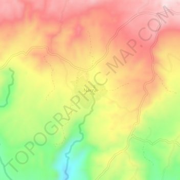
Name: Narra topographic map, elevation, terrain.

Location: Narra, Bayawan, Negros Oriental, Central Visayas, Philippines (9.43126 122.86412 9.47126 122.90412)

Average elevation: 274 m

Minimum elevation: 57 m

Maximum elevation: 438 m

Gear up for your next adventure:

🔦LED Headlamp - Hands-free lighting for early morning starts or late finishes
🧣Merino Neck Gaiter - Protects against wind, sun, and cold at high altitudes
💧Filtered Water Bottle - Safe drinking water on the go
🥤Collapsible Travel Cup - Saves space and weight in your mess kit
🥾Mountaineering Boots - Supportive boots for climbing and high-altitude hiking

As an Amazon Associate, this site earns from qualifying purchases at no extra cost to you.