Geolocate

Cornwerd topographic map

Click on the map to display elevation.

About this map

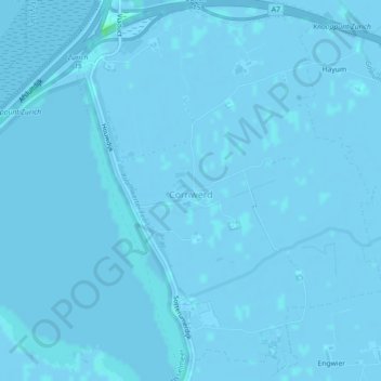
Name: Cornwerd topographic map, elevation, terrain.

Location: Cornwerd, Súdwest-Fryslân, Frisia, Netherlands (53.07096 5.37846 53.09666 5.41456)

Average elevation: 0 m

Minimum elevation: -4 m

Maximum elevation: 5 m

Other topographic maps

Click on a map to view its topography, its elevation and its terrain.

Vierhuizen

Netherlands > Frisia > Allingawier

Average elevation: -2 m

Oost-Vlieland

Netherlands > Frisia

Average elevation: 2 m

Kooiplaats

Netherlands > Frisia > Buren

Average elevation: 1 m

Loënga

Netherlands > Frisia > Loënga

Average elevation: 0 m

Leeuwarden

Netherlands > Frisia > Leeuwarden

Average elevation: 0 m

Gear up for your next adventure:

🛌Down Sleeping Bag - Superior warmth-to-weight ratio for cold nights
Camping Groundsheet - Protect your tent from moisture and dirt
📷Outdoor Action Camera - Capture high-elevation views and rugged adventures
🧥Waterproof Hiking Jacket - Protect yourself from rain and wind while hiking
🔦LED Headtorch - Bright and durable light for night activities

As an Amazon Associate, this site earns from qualifying purchases at no extra cost to you.