
Nil Bleu topographic map
Interactive map
Click on the map to display elevation.
About this map
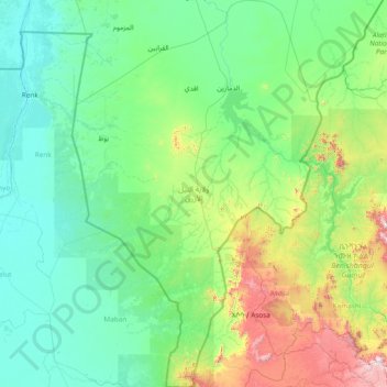
Name: Nil Bleu topographic map, elevation, terrain.
Location: Nil Bleu, Soudan (9.50000 33.13832 12.47905 35.09611)
Average elevation: 628 m
Minimum elevation: 380 m
Maximum elevation: 2,399 m
Other topographic maps
Click on a map to view its topography, its elevation and its terrain.