
Thank you for supporting this site ❤️
Make a donation
Make a donation
Gear up for your next adventure:
As an Amazon Associate, this site earns from qualifying purchases at no extra cost to you.
Lippertsgrün topographic map
Click on the map to display elevation.
Thank you for supporting this site ❤️
Make a donation
Make a donation
Gear up for your next adventure:
As an Amazon Associate, this site earns from qualifying purchases at no extra cost to you.
About this map
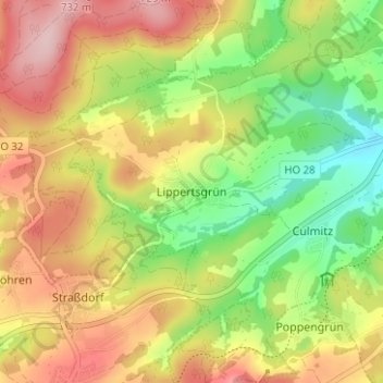
Name: Lippertsgrün topographic map, elevation, terrain.
Location: Lippertsgrün, Naila, Landkreis Hof, Bayern, 95119, Deutschland (50.28650 11.62716 50.32650 11.66716)
Average elevation: 633 m
Minimum elevation: 533 m
Maximum elevation: 735 m
Thank you for supporting this site ❤️
Make a donation
Make a donation
Gear up for your next adventure:
As an Amazon Associate, this site earns from qualifying purchases at no extra cost to you.