
Saint-André topographic map
Interactive map
Click on the map to display elevation.
About this map
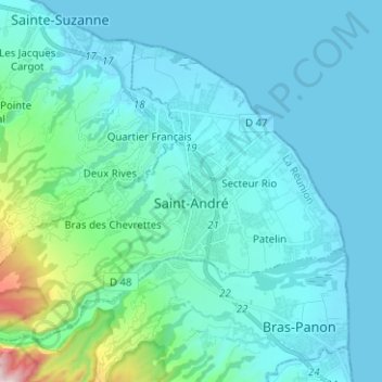
Name: Saint-André topographic map, elevation, terrain.
Location: Saint-André, Saint-Benoît, La Reunión, 97440, Francia (-21.00295 55.57408 -20.91087 55.69949)
Average elevation: 125 m
Minimum elevation: 0 m
Maximum elevation: 1,067 m