Geolocate

Talon topographic map

Click on the map to display elevation.

About this map

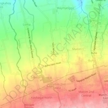
Name: Talon topographic map, elevation, terrain.

Location: Talon, Amadeo, Cavite, Calabarzon, 4119, Philippines (14.11826 120.92015 14.15826 120.96015)

Average elevation: 533 m

Minimum elevation: 451 m

Maximum elevation: 608 m

Gear up for your next adventure:

🛶Canoe Life Vest - Safety vest for water sports
🎒Backpack Rain Cover - External shield to keep your entire pack dry
🧴Waterproofing Spray - Restore the DWR coating on jackets and tents
💡LED Camping Lantern - Illuminate your campsite with long-lasting lanterns
🐕Hiking Dog Pack - Let your canine companion carry their own water and food

As an Amazon Associate, this site earns from qualifying purchases at no extra cost to you.