Geolocate

Valbella topographic map

Click on the map to display elevation.

About this map

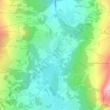
Name: Valbella topographic map, elevation, terrain.

Location: Valbella, Vaz/Obervaz, Albula, Grisons, 7077, Switzerland (46.72579 9.53415 46.76579 9.57415)

Average elevation: 1,720 m

Minimum elevation: 1,413 m

Maximum elevation: 2,426 m

Gear up for your next adventure:

🥘Camping Cookware Set - Compact nesting pots and pans for trail cooking
🧦Hiking Socks - Moisture-wicking and comfortable socks for long hikes
🥾Approach Shoes - Shoes designed for climbing approaches and rugged trails
👟Trail Running Shoes - Agile footwear for fast-paced topographic exploration
🥾Trail Hiking Boots - Supportive boots for rough trails

As an Amazon Associate, this site earns from qualifying purchases at no extra cost to you.