Geolocate

Bato topographic map

Click on the map to display elevation.

About this map
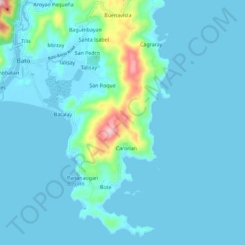
Name: Bato topographic map, elevation, terrain.

Location: Bato, Catanduanes, Bicol Region, 4801, Philippines (13.54627 124.26247 13.62634 124.35064)

Average elevation: 35 m

Minimum elevation: -5 m

Maximum elevation: 351 m

Gear up for your next adventure:

🥾Trekking Poles - Adjustable trekking poles to reduce knee stress and improve stability
🕶️Polarized Sunglasses - Protect your eyes with durable polarized lenses
🧢Outdoor Cap - Protective cap for sun and rain during hikes
🧢Outdoor Visor - Breathable visor for sunny hikes
🛰️Satellite Messenger - Emergency communication for areas with no cell service

As an Amazon Associate, this site earns from qualifying purchases at no extra cost to you.