Geolocate

Konnarock topographic map

Click on the map to display elevation.

About this map

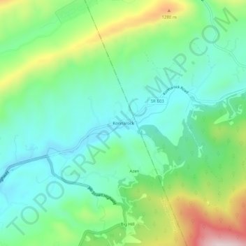
Name: Konnarock topographic map, elevation, terrain.

Location: Konnarock, Washington County, Virginia, United States (36.64595 -81.65817 36.68595 -81.61817)

Average elevation: 1,005 m

Minimum elevation: 873 m

Maximum elevation: 1,315 m

Gear up for your next adventure:

Backpacking Tent - Lightweight tent for long-distance hiking trips
💧Collapsible Water Bottle - Space-saving water bottle for outdoor activities
🥾Hiking Gaiters - Protect legs and shoes from mud, snow, and debris
🧣Merino Neck Gaiter - Protects against wind, sun, and cold at high altitudes
🛁Quick-Dry Microfiber Towel - Space-saving towel that dries rapidly on the move

As an Amazon Associate, this site earns from qualifying purchases at no extra cost to you.