Geolocate

kharkuli topographic map

Click on the map to display elevation.

About this map

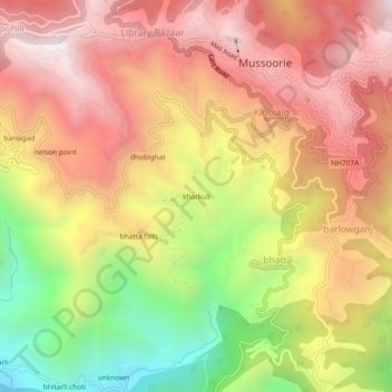
Name: kharkuli topographic map, elevation, terrain.

Location: kharkuli, Mussoorie, Dehradun, Uttarakhand, 248179, India (30.42326 78.05012 30.46326 78.09012)

Average elevation: 1,656 m

Minimum elevation: 954 m

Maximum elevation: 2,181 m

Gear up for your next adventure:

🧳Compression Sacks - Maximize space in your backpack by shrinking gear
🦟Insect Repellent - Keep mosquitoes and black flies away in wooded areas
🦯Trekking Poles - Reduced impact on joints for steep topographic climbs
🧥Packable Rain Jacket - Breathable waterproof layer for unpredictable weather
🔥Camping Stove - Portable stoves to cook outdoors with ease

As an Amazon Associate, this site earns from qualifying purchases at no extra cost to you.