
Haarle topographic map
Interactive map
Click on the map to display elevation.
About this map
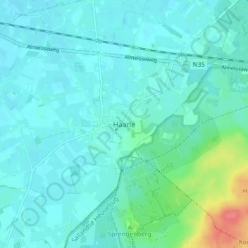
Name: Haarle topographic map, elevation, terrain.
Location: Haarle, Overijssel, Niederlande, 7448, Niederlande (52.33928 6.36430 52.37928 6.40430)
Average elevation: 17 m
Minimum elevation: 6 m
Maximum elevation: 70 m