Geolocate

Lovingston topographic map

Click on the map to display elevation.

About this map

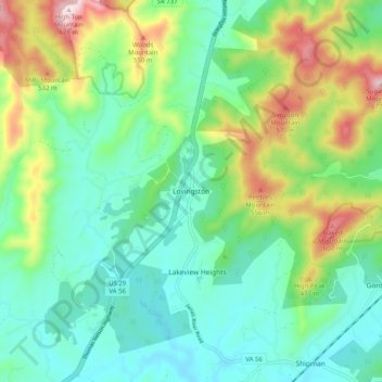
Name: Lovingston topographic map, elevation, terrain.

Location: Lovingston, Nelson County, Virginia, 22949, United States (37.71986 -78.91086 37.79986 -78.83086)

Average elevation: 316 m

Minimum elevation: 170 m

Maximum elevation: 671 m

Gear up for your next adventure:

🔨Vehicle Emergency Tool - Safety tool for remote road trips to trailheads
🧼Biodegradable Camp Soap - Environmentally friendly cleaning for gear and body
🥾Hiking Shoes - Durable and comfortable shoes for trail hiking
💧Reusable Water Bottle - Durable water bottles for hydration on trails
❄️Traction Ice Cleats - Slip-on spikes for icy trails and winter hiking

As an Amazon Associate, this site earns from qualifying purchases at no extra cost to you.