Geolocate

Loma de Oriente topographic map

Click on the map to display elevation.

About this map
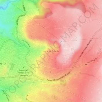
Name: Loma de Oriente topographic map, elevation, terrain.

Location: Loma de Oriente, Zitácuaro, Michoacán, 61502, México (19.41921 -100.35356 19.45921 -100.31356)

Average elevation: 2,069 m

Minimum elevation: 1,817 m

Maximum elevation: 2,203 m

Gear up for your next adventure:

🧤Insulated Winter Gloves - Heavy-duty protection for sub-zero Canadian adventures
🧦Hiking Liner Socks - Thin base layer to prevent friction and blisters
👟Sport Hiking Sandals - Breathable footwear for water crossings and camp rest
🚲MTB Frame Bag - Carry tools and maps directly on your bicycle frame
🌡️Emergency Mylar Blankets - Compact thermal protection for unexpected nights outdoors

As an Amazon Associate, this site earns from qualifying purchases at no extra cost to you.