
Penísula topographic map
Interactive map
Click on the map to display elevation.
About this map
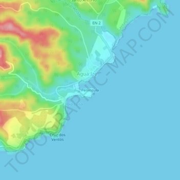
Name: Penísula topographic map, elevation, terrain.
Location: Penísula, Agua Ize, Cantagalo, São Tomé and Príncipe (0.19493 6.70788 0.23493 6.74788)
Average elevation: 27 m
Minimum elevation: 0 m
Maximum elevation: 150 m