
Val-Dieu topographic map
Interactive map
Click on the map to display elevation.
About this map
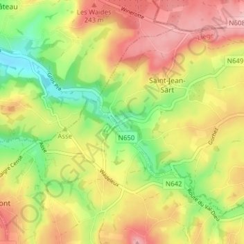
Name: Val-Dieu topographic map, elevation, terrain.
Average elevation: 195 m
Minimum elevation: 118 m
Maximum elevation: 266 m
Other topographic maps
Click on a map to view its topography, its elevation and its terrain.
Saint-Jean-Sart
Belgique > Liège > Verviers > Saint-Jean-Sart
Saint-Jean-Sart, Aubel, Verviers, Liège, Wallonie, 4880, Belgique
Average elevation: 207 m