
Tulfes topographic map
Interactive map
Click on the map to display elevation.
About this map
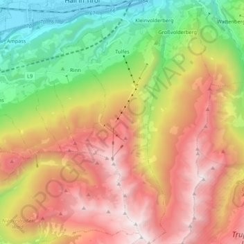
Name: Tulfes topographic map, elevation, terrain.
Location: Tulfes, Innsbruck-Land, Tyrol, 6075, Autriche (47.17087 11.51095 47.28158 11.56324)
Average elevation: 1,610 m
Minimum elevation: 553 m
Maximum elevation: 2,768 m