
Kamiennik / Luboch topographic map
Interactive map
Click on the map to display elevation.
About this map
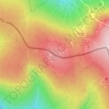
Name: Kamiennik / Luboch topographic map, elevation, terrain.
Average elevation: 1,184 m
Minimum elevation: 977 m
Maximum elevation: 1,323 m
Other topographic maps
Click on a map to view its topography, its elevation and its terrain.
Szklarska Poręba
Poland > Lower Silesian Voivodeship > Karkonosze County > Szklarska Poręba
Szklarska Poręba, Karkonosze County, Lower Silesian Voivodeship, 58-580, Poland
Average elevation: 891 m