Lake Monroe topographic map
Click on the map to display elevation.
Lake Monroe
Lake Monroe is a reservoir located about 10 miles (16 km) southeast of Bloomington, Indiana, United States. The lake is the largest entirely situated in Indiana with 10,750 acres (43.5 km2) of water surface area spread over the counties of Monroe and Brown. Capacity varies from 292 gigalitres (237,000 acre⋅ft) to 428 gigalitres (347,000 acre⋅ft) depending on water level. It is also home to 13,202 acres (53.43 km2) of protected forest and three recreational areas (Fairfax, Hardin Ridge, and Paynetown). Indiana's only federally protected U.S. Wilderness Area, the 13,000-acre (53 km2) Charles C. Deam Wilderness Area, is located on the south shore. The pool elevation (above sea level) is about 538 ft (164 m) year-round. During colder winters, limited ice fishing is available on protected backwater portions of the reservoir.
About this map
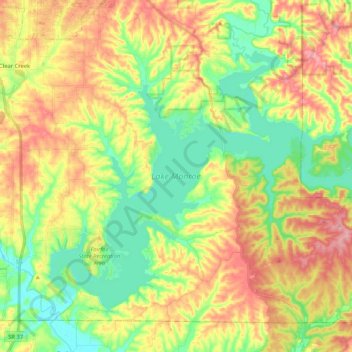
Name: Lake Monroe topographic map, elevation, terrain.
Location: Lake Monroe, Monroe County, Indiana, United States (38.99462 -86.52090 39.12199 -86.31232)
Average elevation: 205 m
Minimum elevation: 150 m
Maximum elevation: 272 m
Other topographic maps
Click on a map to view its topography, its elevation and its terrain.