
Meñaka topographic map
Interactive map
Click on the map to display elevation.
About this map
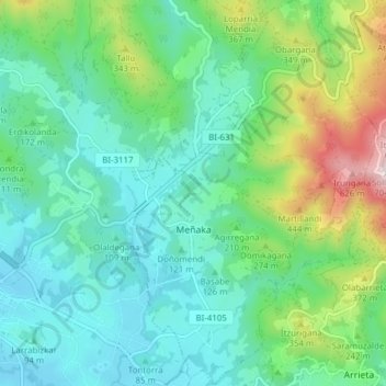
Name: Meñaka topographic map, elevation, terrain.
Location: Meñaka, Mungialdea, Vizcaya, País Vasco, España (43.34009 -2.81458 43.39604 -2.76583)
Average elevation: 183 m
Minimum elevation: 23 m
Maximum elevation: 677 m