Geolocate

Cunninghams Gap topographic map

Click on the map to display elevation.

About this map

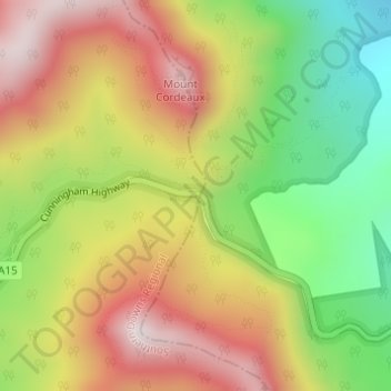
Name: Cunninghams Gap topographic map, elevation, terrain.

Location: Cunninghams Gap, Warwick, Queensland, 4370, Australia (-28.05988 152.38426 -28.03988 152.40426)

Average elevation: 781 m

Minimum elevation: 420 m

Maximum elevation: 1,130 m

Other topographic maps

Click on a map to view its topography, its elevation and its terrain.

Condamine River

Australia > Queensland > Warwick

Average elevation: 844 m

Gear up for your next adventure:

🧦Hiking Socks - Moisture-wicking and comfortable socks for long hikes
💡LED Camping Lantern - Illuminate your campsite with long-lasting lanterns
🧣Merino Neck Gaiter - Protects against wind, sun, and cold at high altitudes
🧢Outdoor Visor - Breathable visor for sunny hikes
🧥Fleece Jacket - Warm and lightweight jacket for layering

As an Amazon Associate, this site earns from qualifying purchases at no extra cost to you.