
Lakefield topographic map
Interactive map
Click on the map to display elevation.
About this map
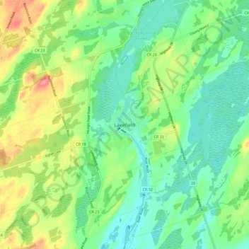
Name: Lakefield topographic map, elevation, terrain.
Average elevation: 248 m
Minimum elevation: 220 m
Maximum elevation: 302 m
Other topographic maps
Click on a map to view its topography, its elevation and its terrain.
Ennismore
Canada > Ontario > Peterborough County > Selwyn
Ennismore, Selwyn, Peterborough County, Central Ontario, Ontario, K0L 1T0, Canada
Average elevation: 271 m
Curve Lake First Nation
Canada > Ontario > Peterborough County > Selwyn > Young's Point
Curve Lake First Nation, Young's Point, Selwyn, Peterborough County, Central Ontario, Ontario, K0L 1R0, Canada
Average elevation: 247 m
Chemong Lake
Canada > Ontario > Peterborough County > Selwyn > Bridgenorth
Chemong Lake, Bridgenorth, Selwyn, Peterborough County, Central Ontario, Ontario, Canada
Average elevation: 256 m