
La Isla topographic map
Interactive map
Click on the map to display elevation.
About this map
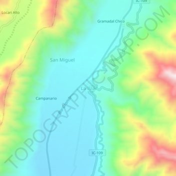
Name: La Isla topographic map, elevation, terrain.
Location: La Isla, Río Grande, Provincia de Palpa, Ica, Perú (-14.46344 -75.21097 -14.42344 -75.17097)
Average elevation: 594 m
Minimum elevation: 401 m
Maximum elevation: 1,039 m