
Atung Bungsu topographic map
Interactive map
Click on the map to display elevation.
About this map
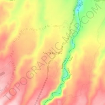
Name: Atung Bungsu topographic map, elevation, terrain.
Location: Atung Bungsu, Pagar Alam, South Sumatra, Indonesia (-4.03206 103.38255 -3.99206 103.42255)
Average elevation: 521 m
Minimum elevation: 341 m
Maximum elevation: 627 m