Geolocate

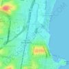
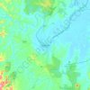
Culburra Beach topographic map

Click on the map to display elevation.

About this map
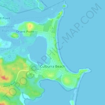
Name: Culburra Beach topographic map, elevation, terrain.

Location: Culburra Beach, Shoalhaven City Council, New South Wales, 2540, Australia (-34.94764 150.72508 -34.89623 150.78626)

Average elevation: 5 m

Minimum elevation: -1 m

Maximum elevation: 40 m

Other topographic maps

Click on a map to view its topography, its elevation and its terrain.
Rose Seidler House

Australia > New South Wales > Sydney

Average elevation: 153 m

Mount Annan

Australia > New South Wales > Sydney

Average elevation: 115 m

Herron Park

Australia > New South Wales > Sydney

Average elevation: 28 m

Grafton

Australia > New South Wales

Average elevation: 36 m

Dark Gully Reserve

Australia > New South Wales > Sydney

Average elevation: 14 m

Castle Mountain

Australia > New South Wales > Quirindi

Average elevation: 578 m

Poley Mountain

Australia > New South Wales

Average elevation: 465 m

Comara

Australia > New South Wales

Average elevation: 909 m

Gear up for your next adventure:

🧥Waterproof Jacket - Lightweight rain jackets for hiking and outdoor activities
🔭Compact Monocular - One-handed bird watching and trail spotting
🔦LED Headtorch - Bright and durable light for night activities
🧢Outdoor Cap - Protective cap for sun and rain during hikes
🥾Lightweight Hiking Shoes - Comfortable shoes for day hikes

As an Amazon Associate, this site earns from qualifying purchases at no extra cost to you.