
Zárate topographic map
Interactive map
Click on the map to display elevation.
About this map
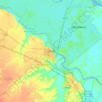
Name: Zárate topographic map, elevation, terrain.
Location: Zárate, Partido de Zárate, Buenos Aires, 2800, Argentina (-34.25547 -59.18451 -33.93547 -58.86451)
Average elevation: 12 m
Minimum elevation: -4 m
Maximum elevation: 40 m