Geolocate

Restrepo topographic map

Click on the map to display elevation.

About this map

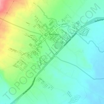
Name: Restrepo topographic map, elevation, terrain.

Location: Restrepo, Piedemonte, Meta, Colombia (4.24722 -73.57327 4.26662 -73.55629)

Average elevation: 478 m

Minimum elevation: 439 m

Maximum elevation: 556 m

Gear up for your next adventure:

🧰Emergency Multi-Tool - Compact multi-tool for outdoor survival
🚑Survival Whistle - Signal for help across long distances in mountains
🔋Lithium AA Batteries - Long-lasting power that performs in extreme cold
🔥Emergency Fire Starter - Reliable ignition source for all weather conditions
🦌Outdoor Trail Camera - Monitor wildlife activity near your favorite spots

As an Amazon Associate, this site earns from qualifying purchases at no extra cost to you.