Geolocate

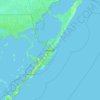
El Chico topographic map

Click on the map to display elevation.

About this map

Name: El Chico topographic map, elevation, terrain.

Location: El Chico, Monroe County, Florida, United States (24.57828 -81.68098 24.61828 -81.64098)

Average elevation: 0 m

Minimum elevation: -2 m

Maximum elevation: 5 m

Other topographic maps

Click on a map to view its topography, its elevation and its terrain.
Tavernier

United States > Florida > Monroe County > Tavernier

Average elevation: 2 m

Key

United States > Florida > Monroe County

Average elevation: 0 m

Key Largo

United States > Florida > Monroe County > Key Largo

Average elevation: 1 m

Layton

United States > Florida > Monroe County

Average elevation: 1 m

Key Largo

United States > Florida > Monroe County

Average elevation: 1 m

Sawyer Key

United States > Florida > Monroe County

Average elevation: 0 m

Crab Key

United States > Florida > Monroe County

Average elevation: 0 m

Fish Hawk Key

United States > Florida > Monroe County

Average elevation: 0 m

Gear up for your next adventure:

⛺Lightweight Backpacking Tent - Compact tent for efficient hiking trips
🥾Light Hiking Boots - Lightweight and comfortable boots for day hikes
🧭GPS Outdoor Watch - Smart watch for navigation and fitness tracking in nature
🧢Sun Protection Cap - Breathable cap to protect from sun exposure
🥾Waterproof Trail Shoes - Shoes designed to handle wet terrain

As an Amazon Associate, this site earns from qualifying purchases at no extra cost to you.