Geolocate

Upper Geyser Basin topographic map

Click on the map to display elevation.

About this map

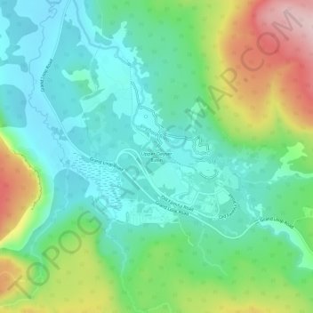
Name: Upper Geyser Basin topographic map, elevation, terrain.

Location: Upper Geyser Basin, Teton County, Wyoming, United States (44.44228 -110.85741 44.48228 -110.81741)

Average elevation: 2,295 m

Minimum elevation: 2,213 m

Maximum elevation: 2,485 m

Gear up for your next adventure:

🧤Rechargeable Heated Gloves - Extreme warmth for Canadian winter expeditions
🔨Vehicle Emergency Tool - Safety tool for remote road trips to trailheads
🧦Merino Wool Socks - Moisture-wicking comfort for long-distance hiking
🌡️Emergency Mylar Blankets - Compact thermal protection for unexpected nights outdoors
🐕Hiking Dog Pack - Let your canine companion carry their own water and food

As an Amazon Associate, this site earns from qualifying purchases at no extra cost to you.