
Goat River topographic map
Click on the map to display elevation.
About this map
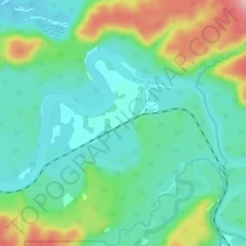
Name: Goat River topographic map, elevation, terrain.
Average elevation: 705 m
Minimum elevation: 653 m
Maximum elevation: 855 m
Other topographic maps
Click on a map to view its topography, its elevation and its terrain.
Berg Lake
Canada > British Columbia > Regional District of Fraser-Fort George > Area H (Robson Valley/Canoe)
Average elevation: 1,798 m