

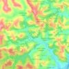
Rio Juqueri topographic map
Click on the map to display elevation.
About this map

Name: Rio Juqueri topographic map, elevation, terrain.
Average elevation: 765 m
Minimum elevation: 721 m
Maximum elevation: 850 m
Other topographic maps
Click on a map to view its topography, its elevation and its terrain.

Nascente (Afloramento D'água do Lençol Fréatico)
Brasil > São Paulo > Região Metropolitana de São Paulo > Franco da Rocha
Average elevation: 764 m
Sitio Borda da Mata
Brasil > São Paulo > Região Metropolitana de São Paulo > Franco da Rocha
Average elevation: 793 m

Vila Guarani
Brasil > São Paulo > Região Metropolitana de São Paulo > Franco da Rocha
Average elevation: 772 m

Parque Estadual do Juquery
Brasil > São Paulo > Região Metropolitana de São Paulo > Franco da Rocha
Relevo de mar de morros, caracterizado pelos topos arredondados, vertentes com perfis convexos a retilíneos. Drenagem de alta densidade, padrão dendrífico a retangular, vales abertos a fechados, planícies aluvionares interiores desenvolvidas. Constitui geralmente um conjunto de formas em “Meia…
Average elevation: 796 m