
Thank you for supporting this site ❤️
Make a donation
Make a donation
Gear up for your next adventure:
As an Amazon Associate, this site earns from qualifying purchases at no extra cost to you.
Battalmustafa topographic map
Click on the map to display elevation.
Thank you for supporting this site ❤️
Make a donation
Make a donation
Gear up for your next adventure:
As an Amazon Associate, this site earns from qualifying purchases at no extra cost to you.
About this map
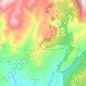
Name: Battalmustafa topographic map, elevation, terrain.
Location: Battalmustafa, Kula, Manisa, Aegean Region, Turkey (38.36763 28.71988 38.40763 28.75988)
Average elevation: 667 m
Minimum elevation: 389 m
Maximum elevation: 995 m
Thank you for supporting this site ❤️
Make a donation
Make a donation
Gear up for your next adventure:
As an Amazon Associate, this site earns from qualifying purchases at no extra cost to you.