
Thank you for supporting this site ❤️
Make a donation
Make a donation
Gear up for your next adventure:
As an Amazon Associate, this site earns from qualifying purchases at no extra cost to you.
Lanzós topographic map
Click on the map to display elevation.
Thank you for supporting this site ❤️
Make a donation
Make a donation
Gear up for your next adventure:
As an Amazon Associate, this site earns from qualifying purchases at no extra cost to you.
About this map
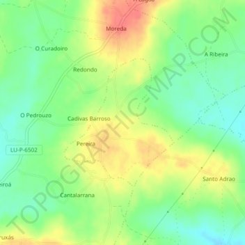
Name: Lanzós topographic map, elevation, terrain.
Location: Lanzós, Vilalba, Terra Chá, Lugo, Galicia, Spain (43.34925 -7.64383 43.36345 -7.62717)
Average elevation: 465 m
Minimum elevation: 439 m
Maximum elevation: 497 m
Thank you for supporting this site ❤️
Make a donation
Make a donation
Gear up for your next adventure:
As an Amazon Associate, this site earns from qualifying purchases at no extra cost to you.