Geolocate

Tytsjerk topographic map

Click on the map to display elevation.

About this map

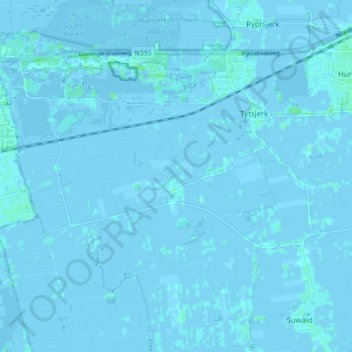
Name: Tytsjerk topographic map, elevation, terrain.

Location: Tytsjerk, Tytsjerksteradiel, Frisia, Netherlands (53.18156 5.85096 53.21786 5.93762)

Average elevation: 0 m

Minimum elevation: -4 m

Maximum elevation: 5 m

Other topographic maps

Click on a map to view its topography, its elevation and its terrain.

Oost-Vlieland

Netherlands > Frisia

Average elevation: 2 m

Kooiplaats

Netherlands > Frisia > Buren

Average elevation: 1 m

Loënga

Netherlands > Frisia > Loënga

Average elevation: 0 m

Vierhuizen

Netherlands > Frisia > Allingawier

Average elevation: -2 m

Leeuwarden

Netherlands > Frisia > Leeuwarden

Average elevation: 0 m

Gear up for your next adventure:

🧭GPS Handheld Device - Reliable GPS navigation for outdoor adventures
🥾Mountain Hiking Boots - High-traction boots for rocky terrain
🧴Waterproofing Spray - Restore the DWR coating on jackets and tents
🧼Biodegradable Camp Soap - Environmentally friendly cleaning for gear and body
🧦Outdoor Socks - Durable socks designed for hiking and outdoor sports

As an Amazon Associate, this site earns from qualifying purchases at no extra cost to you.