Geolocate

Bayard topographic map

Click on the map to display elevation.

About this map

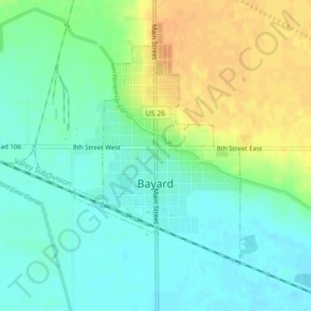
Name: Bayard topographic map, elevation, terrain.

Location: Bayard, Morrill County, Nebraska, 69334, United States (41.74839 -103.33374 41.76746 -103.31442)

Average elevation: 1,154 m

Minimum elevation: 1,141 m

Maximum elevation: 1,173 m

Gear up for your next adventure:

🥾Trail Running Shoes - Lightweight and durable shoes for trail running
🔨Vehicle Emergency Tool - Safety tool for remote road trips to trailheads
💧Collapsible Water Bottle - Space-saving water bottle for outdoor activities
Camping Coffee Maker - Brew fresh coffee anywhere on the topographic map
🥾Hiking Shoes - Durable and comfortable shoes for trail hiking

As an Amazon Associate, this site earns from qualifying purchases at no extra cost to you.