Geolocate

Trident Bay topographic map

Click on the map to display elevation.

About this map

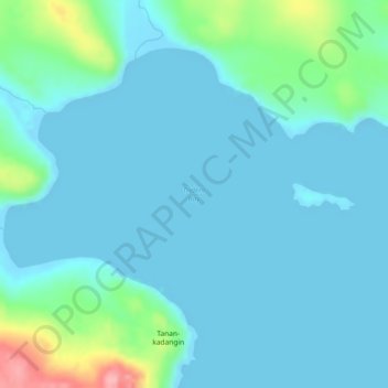
Name: Trident Bay topographic map, elevation, terrain.

Location: Trident Bay, Aleutians East, Alaska, United States (54.13884 -165.53755 54.13894 -165.53745)

Average elevation: 19 m

Minimum elevation: -6 m

Maximum elevation: 128 m

Other topographic maps

Click on a map to view its topography, its elevation and its terrain.

Sand Point

United States > Alaska > Aleutians East

Average elevation: 39 m

Water Basin

United States > Alaska > Aleutians East

Average elevation: 130 m

Cold Bay

United States > Alaska > Aleutians East

Average elevation: 62 m

Nelson Lagoon

United States > Alaska > Aleutians East

Average elevation: 46 m

Gear up for your next adventure:

🧥Waterproof Jacket - Lightweight rain jackets for hiking and outdoor activities
🧤Insulated Winter Gloves - Heavy-duty protection for sub-zero Canadian adventures
🧦Outdoor Socks - Durable socks designed for hiking and outdoor sports
🥤Collapsible Travel Cup - Saves space and weight in your mess kit
🦌Outdoor Trail Camera - Monitor wildlife activity near your favorite spots

As an Amazon Associate, this site earns from qualifying purchases at no extra cost to you.