Make a donation
Gear up for your next adventure:
As an Amazon Associate, this site earns from qualifying purchases at no extra cost to you.
Biggar topographic map
Click on the map to display elevation.
Make a donation
Gear up for your next adventure:
As an Amazon Associate, this site earns from qualifying purchases at no extra cost to you.
Biggar
Biggar has an oceanic climate (Köppen: Cfb). Camps Reservoir is a nearby weather station situated at an elevation of 295 m (968 ft).
Make a donation
Gear up for your next adventure:
As an Amazon Associate, this site earns from qualifying purchases at no extra cost to you.
About this map
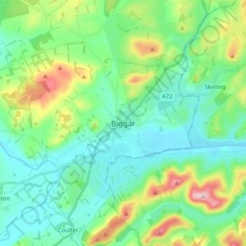
Name: Biggar topographic map, elevation, terrain.
Location: Biggar, South Lanarkshire, Scotland, ML12 6AE, United Kingdom (55.58449 -3.56158 55.66449 -3.48158)
Average elevation: 254 m
Minimum elevation: 193 m
Maximum elevation: 431 m
Make a donation
Gear up for your next adventure:
As an Amazon Associate, this site earns from qualifying purchases at no extra cost to you.
