Geolocate

Joura topographic map

Click on the map to display elevation.

About this map

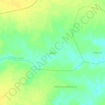
Name: Joura topographic map, elevation, terrain.

Location: Joura, Indergarh Tahsil, Datia, Madhya Pradesh, India (25.77597 78.63031 25.81597 78.67031)

Average elevation: 176 m

Minimum elevation: 164 m

Maximum elevation: 187 m

Other topographic maps

Click on a map to view its topography, its elevation and its terrain.

Gohna

India > Madhya Pradesh > Indergarh Tahsil > Gohana

Average elevation: 195 m

Jaswantpura

India > Madhya Pradesh > Indergarh Tahsil

Average elevation: 189 m

Bandapura

India > Madhya Pradesh > Indergarh Tahsil

Average elevation: 190 m

Gear up for your next adventure:

🥾Mountaineering Boots - Supportive boots for climbing and high-altitude hiking
🛶Waterproof Dry Bags - Keep electronics and clothes dry during river crossings
🔦LED Headlamp - Hands-free lighting for early morning starts or late finishes
👟Sport Hiking Sandals - Breathable footwear for water crossings and camp rest
🥾Hiking Leggings - Comfortable leggings for outdoor activities

As an Amazon Associate, this site earns from qualifying purchases at no extra cost to you.