Geolocate

Big Fork topographic map

Click on the map to display elevation.

About this map

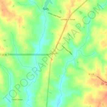
Name: Big Fork topographic map, elevation, terrain.

Location: Big Fork, Mecklenburg County, Virginia, United States (36.65153 -78.23277 36.69153 -78.19277)

Average elevation: 88 m

Minimum elevation: 64 m

Maximum elevation: 114 m

Other topographic maps

Click on a map to view its topography, its elevation and its terrain.

Chase City

United States > Virginia > Mecklenburg County

Average elevation: 153 m

Gear up for your next adventure:

🧴First Aid Kit - Essential first aid supplies for outdoor emergencies
🥫Freeze-Dried Meals - Lightweight, high-calorie nutrition for multi-day treks
🕶️Polarized Sunglasses - Reduces glare from snow and water at high elevations
💧Filtered Water Bottle - Safe drinking water on the go
💧Collapsible Water Bottle - Space-saving water bottle for outdoor activities

As an Amazon Associate, this site earns from qualifying purchases at no extra cost to you.