Geolocate

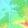
Back Creek topographic map

Click on the map to display elevation.

About this map

Name: Back Creek topographic map, elevation, terrain.

Location: Back Creek, Epsom, Bendigo, City of Greater Bendigo, Victoria, Australia (-36.68916 144.32715 -36.68774 144.32759)

Average elevation: 188 m

Minimum elevation: 176 m

Maximum elevation: 211 m

Other topographic maps

Click on a map to view its topography, its elevation and its terrain.

Maiden Gully

Australia > Victoria > Bendigo

Average elevation: 234 m

East Bendigo

Australia > Victoria > Bendigo

Average elevation: 217 m

Strathfieldsaye

Australia > Victoria > Bendigo

Average elevation: 233 m

Lockwood

Australia > Victoria > Bendigo

Average elevation: 257 m

Wellsford

Australia > Victoria > Bendigo

Average elevation: 201 m

Flora Hill

Australia > Victoria > Bendigo

Average elevation: 261 m

Junortoun

Australia > Victoria > Bendigo

Average elevation: 209 m

Kangaroo Flat

Australia > Victoria > Bendigo

Average elevation: 283 m

Gear up for your next adventure:

🏃Hydration Running Vest - Carry water and maps close to your body for speed
🥾Trail Hiking Socks - Comfortable socks to prevent blisters and fatigue
🩹Moleskin Blister Pads - Direct protection for painful foot pressure points
🥾Durable Hiking Shoes - Long-lasting shoes for frequent hiking
🛁Quick-Dry Microfiber Towel - Space-saving towel that dries rapidly on the move

As an Amazon Associate, this site earns from qualifying purchases at no extra cost to you.