Geolocate

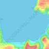
Kermenguy topographic map

Click on the map to display elevation.

About this map

Name: Kermenguy topographic map, elevation, terrain.

Location: Kermenguy, Saint-Efflam, Plestin-les-Grèves, Lannion, Côtes-d'Armor, Bretagne, France métropolitaine, 22310, France (48.63418 -3.64656 48.67418 -3.60656)

Average elevation: 61 m

Minimum elevation: -1 m

Maximum elevation: 132 m

Other topographic maps

Click on a map to view its topography, its elevation and its terrain.
Gear up for your next adventure:

🚲Handlebar Phone Mount - View topographic-map.com live while cycling
🥾Light Trekking Boots - Supportive boots for multi-day treks
🧴First Aid Kit - Essential first aid supplies for outdoor emergencies
🦯Trekking Poles - Reduced impact on joints for steep topographic climbs
🛌Down Sleeping Bag - Superior warmth-to-weight ratio for cold nights

As an Amazon Associate, this site earns from qualifying purchases at no extra cost to you.