
Make a donation
Gear up for your next adventure:
As an Amazon Associate, this site earns from qualifying purchases at no extra cost to you.
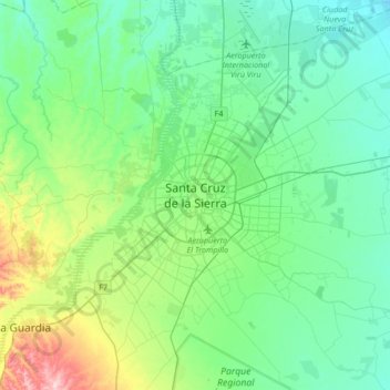
Santa Cruz de la Sierra topographic map
Click on the map to display elevation.
Make a donation
Gear up for your next adventure:
As an Amazon Associate, this site earns from qualifying purchases at no extra cost to you.
Santa Cruz de la Sierra
The city was first founded in 1561 by Spanish explorer Ñuflo de Chavez about 200 km (124 mi) east of its current location, and was moved several times until it was finally established on the Pirai River in the late 16th century. For much of its history, Santa Cruz was mostly a small outpost town, and even after Bolivia gained its independence in 1825 there was little attention from the authorities or the population in general to settle the region. It was not until after the middle of the 20th century with profound agrarian and land reforms that the city began to grow at a very fast pace. Due to its low elevation at the foothills of the Andes, the city has a tropical climate unlike the other main metro area of La Paz that is a couple of miles higher in terms of elevation.
Make a donation
Gear up for your next adventure:
As an Amazon Associate, this site earns from qualifying purchases at no extra cost to you.
About this map
Name: Santa Cruz de la Sierra topographic map, elevation, terrain.
Average elevation: 409 m
Minimum elevation: 344 m
Maximum elevation: 650 m
Make a donation
Gear up for your next adventure:
As an Amazon Associate, this site earns from qualifying purchases at no extra cost to you.