
Make a donation
Gear up for your next adventure:
As an Amazon Associate, this site earns from qualifying purchases at no extra cost to you.
Küssaburg topographic map
Click on the map to display elevation.
Make a donation
Gear up for your next adventure:
As an Amazon Associate, this site earns from qualifying purchases at no extra cost to you.
Küssaburg
Die Höhenburg ist historisches Baudenkmal am Hochrhein und ein Wahrzeichen des Landkreises. In den Anfangsjahren der Wertschätzung von Archäologie im 19. Jh. schützte ein erstes Gesetz die Erhaltung und Freilegung der Burgruine (1855), die heute ein beliebtes Ausflugsziel in der Region ist. Die Gesetzgebung stoppte den Abbruch von Baumaterial und lenkte Schatzgräberei in geordnete Bahnen. Erste Ausgrabungen waren noch abenteuerlich und bereits mit Aufwand zur Dokumentation verbunden.
Make a donation
Gear up for your next adventure:
As an Amazon Associate, this site earns from qualifying purchases at no extra cost to you.
About this map
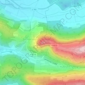
Name: Küssaburg topographic map, elevation, terrain.
Average elevation: 456 m
Minimum elevation: 363 m
Maximum elevation: 649 m
Make a donation
Gear up for your next adventure:
As an Amazon Associate, this site earns from qualifying purchases at no extra cost to you.