
Fonte Cerreto topographic map
Interactive map
Click on the map to display elevation.
About this map
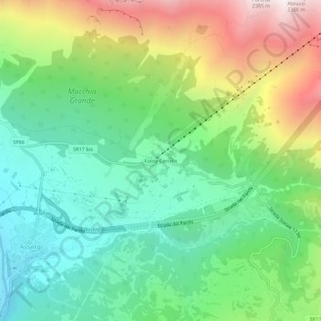
Name: Fonte Cerreto topographic map, elevation, terrain.
Location: Fonte Cerreto, L'Aquila, Abruzzo, Italia (42.40601 13.50911 42.44601 13.54911)
Average elevation: 1,329 m
Minimum elevation: 813 m
Maximum elevation: 2,300 m
Other topographic maps
Click on a map to view its topography, its elevation and its terrain.