Geolocate

Boek topographic map

Click on the map to display elevation.

About this map

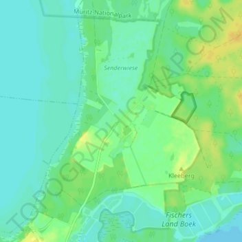
Name: Boek topographic map, elevation, terrain.

Location: Boek, Rechlin, Röbel-Müritz, Mecklenburgische Seenplatte, Mecklenburg-Vorpommern, Deutschland (53.37315 12.77245 53.41315 12.81245)

Average elevation: 65 m

Minimum elevation: 57 m

Maximum elevation: 79 m

Gear up for your next adventure:

🥾Waterproof Hiking Shoes - Durable shoes for wet and rugged trails
🏕️Camping Hammock - Integrated protection for sleeping between trees
🕶️Polarized Sunglasses - Reduces glare from snow and water at high elevations
🔭Outdoor Binoculars - Lightweight binoculars for birdwatching and hiking
🥾Lightweight Hiking Boots - Boots for comfort and mobility on long hikes

As an Amazon Associate, this site earns from qualifying purchases at no extra cost to you.