Geolocate

Kentuck topographic map

Click on the map to display elevation.

About this map

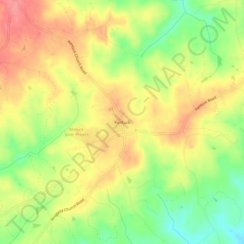
Name: Kentuck topographic map, elevation, terrain.

Location: Kentuck, Pittsylvania County, Virginia, 24566, United States (36.63986 -79.31835 36.67986 -79.27835)

Average elevation: 208 m

Minimum elevation: 157 m

Maximum elevation: 251 m

Other topographic maps

Click on a map to view its topography, its elevation and its terrain.

Gretna

United States > Virginia > Pittsylvania County

Average elevation: 253 m

Hurt

United States > Virginia > Pittsylvania County

Average elevation: 194 m

Gretna

United States > Virginia > Pittsylvania County

Average elevation: 253 m

Chatham

United States > Virginia > Pittsylvania County

Average elevation: 209 m

Chatham

United States > Virginia > Pittsylvania County

Average elevation: 209 m

Gear up for your next adventure:

🧰Emergency Multi-Tool - Compact multi-tool for outdoor survival
🚲Handlebar Phone Mount - View topographic-map.com live while cycling
🛏️Camping Sleeping Mat - Comfortable mats for sleeping outdoors
Camping Coffee Maker - Brew fresh coffee anywhere on the topographic map
🛰️Satellite Messenger - Emergency communication for areas with no cell service

As an Amazon Associate, this site earns from qualifying purchases at no extra cost to you.