Geolocate

Taylor topographic map

Click on the map to display elevation.

About this map

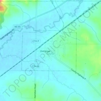
Name: Taylor topographic map, elevation, terrain.

Location: Taylor, Jackson County, Wisconsin, United States (44.31642 -91.13076 44.32731 -91.11023)

Average elevation: 274 m

Minimum elevation: 264 m

Maximum elevation: 324 m

Gear up for your next adventure:

🥾Waterproof Hiking Boots - Boots keeping your feet dry in wet conditions
🧢Sun Protection Cap - Breathable cap to protect from sun exposure
🔋Lithium AA Batteries - Long-lasting power that performs in extreme cold
🥾Trekking Poles - Adjustable trekking poles to reduce knee stress and improve stability
🧊Insulated Water Bottle - Keeps drinks cold in summer and prevents freezing in winter

As an Amazon Associate, this site earns from qualifying purchases at no extra cost to you.